GeoPose & POI Interoperability Demos
for an Open Spatial Web Platform
at W3C Immersive Web Face-to-Face Event
in Mountain View
Purpose of the demonstrations:
These demos show how different Augmented Reality Clients are able to visualize geospatially-anchored content and leverage an existing open standard (OGC GeoPose 1.0 Data Exchange Standard) together with another open standard
(OGC Points of Interest (POI) Conceptual Model Standard). This requires implementations both on the client- and server-side. Both clients ask for a GeoPose estimate from an OSCP GeoPose Service. And there is a POI content provider services (for the POIs), as well as a different OSCP Content discovery service for 3D objects anchored to the world with GeoPose.
Information about the standards can be found here:
OGC GeoPose Data Exchange Standard 1.0
OGC Points of Interest (POI) Conceptual Data Model Standard
Information about the OSCP services that are used to localize and find content are found here:
https://github.com/OpenArCloud/oscp-geopose-protocol
https://github.com/OpenArCloud/oscp-spatial-content-discovery
How does the demo work?
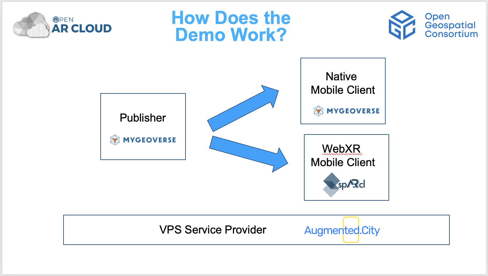
1) There is a VPS (Visual Positioning Service) provider, a content publishing platform and two smartphone spatial browser clients involved in this demo. These are:
A VPS Service Provider:
Augmented City provides Geopose estimates to the spatial browser apps. Augmented City is a member of Open AR Cloud and its VPS service is compliant with OGC standards.
A Content Publishing Platform:
MyGeoVerse spatial content management platform by XR Masters includes the MyGeoVerse spatial browser mobile client
app, capable of publishing 3D GLB assets and creating 3D POIs, all compliant with OGC standards. XR Masters is a member of Open AR Cloud.
Two Spatial Browsers:
A) SpARcl Webxr spatial browser, a mobile webXR client by Open AR Cloud,
B) MyGeoVerse spatial browser, a native mobile app by XR Masters,
2) Both MyGeoVerse and spARcl clients can connect to an OSCP GeoPose service using the Visual Positioning (VPS) implementation from Augmented City. This service is referred to as the GeoPose VPS server. Both clients send camera images and metadata to the GeoPose VPS server and receive their GeoPose estimates in return.
3) With GeoPose estimates, the clients should have an accurate understanding of the smartphone's real-world position and orientation (GeoPose).
4) The clients query POI services and OSCP Content discovery services to learn if there is any content at real world locations near the user that can be displayed.
5) If such content exists the clients display the content from different providers correctly at the real world position where the content is intended to be.
Location
Google Campus
In front of Building 43
1612 Charleston Rd, Mountain View, CA 94043
Follow the steps below to first create a POI and to place a 3D OGC Logo and then view them using MyGeoVerse native app.
(Steps 1 through 4).
Then view the same content using the web browser spARcl. (Step 5)
If you are at Google Campuses, you can try the demos yourself!
Download MyGeoVerse spatial browser app on Apple App Store or Google Play Store.
After downloading, open the MyGeoVerse App and register.
Step 2:
Step 1:
Watch the “How 2 Localize” video to find where the AR experience start.
Once you are there hit the “Start” button to localize as instructed.
If you don’t want to author content, and just would like to view the content previously authored, you can see the “OGC logo” in front of you and the POI that says “Fire Hydrant” next to the hydrant.
Step 3:
If you would like to create content and run the demo yourself, please proceed as below:
Once localized, click the “Plus” sign to see the content database.
Write “OGC” on the search field and click on the OGC (GLB) logo and hit the “Select” button.
Then tap the screen to place the logo at your desired location.
Step 4:
Select “Create POI” on the app menu and tap to place the POI at your desired location.
Then, fill in the form about the POI you would like to create. When you are done, hit “Create”.
Congratulations!
You have created a POI and placed a Logo (glb format)..
Now, you can restart MyGeoVerse and view the content you created, hopefully, at the exact location you placed them. If so, you can now move onto the next step and view the same content using the spARcl Webxr web browser.
Step 5:
Follow the instructions below to view the same content with spARcl !


